 The CERES S’COOL Project The CERES S’COOL Project
Participants received a hands-on demonstration of the S’COOL project that aims to collect data on cloud type, height, cover and related conditions from all over the world. Personnel from NASA Langley Research Center showed the power that clouds have in our atmosphere. It is clouds, in part, that affect the overall temperature and energy balance of the Earth. The more we know about clouds, the more we will know about our Earth as a system. The S’COOL observations help NASA to validate satellite data and give us a more complete picture of clouds in the atmosphere and their interactions with other parts of the integrated global Earth system.
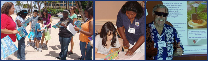
Digital Earth Watch (DEW) and Picture Post Network
This workshop provided information on how a community network and simple sensor platform for systematic monitoring of local environmental conditions can be used to study change over time in their local area. Participants compared digital images with satellite imagery and contributed towards improving their own communities. Workshop directors helped participants share their digital photographs on the Picture Post website and to study and analyze findings using DEW software.
GeoINT Online Communities
During IGARSS 2010, Global Marketing Insights, Inc. provided project training on the National Geospatial-Intelligence Agency GeoINT Online Communities website focused on Global Food Security. This is a private/public sector project with the National Geospatial-Intelligence Agency and United States Department of Agriculture. The workshop showed how to give input into the system which impacts all our lives and our dinner tables.
NOAA Seminars
Representatives of the National Oceanic and Atmospheric Administration conducted discussions and demonstrations of educational products which help build understanding of the science of Earth’s systems and the stewardship of our planet. iPhone® applications that link to satellite overpasses were displayed in addition to the workshops.
IGARSS Scavenger Hunt
Students wrote four questions that they asked the scientist and vendors. They took their questions to the E-O booth for approval and signature. Students asked questions about remote sensing, why they enjoy their job, what subjects are most important to study, what does a certain word or image mean, what is the importance of remote sensing, what is GIS, what is GPS, etc. Students then visited vendor booths and met with the scientists.
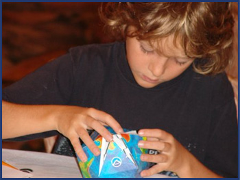
CERSER/IGARSS Remote Sensing Art Workshop
Students provided a visual insight into how experiences at IGARSS 2010 impacted them. These visualizations included some of the highlights of IGARSS 2010 including registration, exhibits, people, posters, etc. to design of an IGARSS 2010 mouse pad. Mouse pads and paints were provided by The ECSU Center of Excellence in Remote Sensing Education and Research (CERSER).
IGARSS 2010 Exhibit Hall
IGARSS 2010 brought together over 2,000 engineers, researchers, teachers, students, and scientists from around the world to review the latest issues and studies of Earth remote sensing, and their environments in space. Interact with companies, government agencies, educational institutions, research facilities, scientific societies, and others exhibiting the latest in geoscience instruments, equipment, software, books and journals, and scientific programs at the International Geoscience and Remote Sensing Symposium.
IGARSS 2010 Research and Education Poster Sessions
Remote sensing scientists, educators and students presented their investigations in hundreds of engaging posters, which allowed students to interact with them one-on-one.
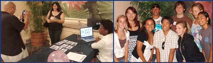
IGARSS and You Photo Shoot
Students had their photo taken and printed on the cover of the IGARSS Education Outreach program flier.
|