| Student Posters |
 |
| Human Impacts on the Water Quality of the Pasquotank - Mentor: Jeff Schloss |
| James L. Webb (ECSU), Ryan D. Lawrence (ECSU), Amanda A. Piwowarski (ECSU), Montravias D. King (ECSU), Andrew Milam (COA), Shaveon Boone (ECSU), Lintavia Adams (ECSU), |
 ABSTRACT ABSTRACT
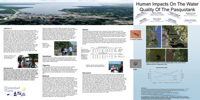
Most people don't know that they could be contributing to adverse water quality changes right in their own backyards. How? Well because, we all live in watersheds, an area that drains to a common waterway. In order to determine how development, farmlands and water treatment plants affect water quality, we visited various locations near agriculture sites, urban development and waste treatment facilities along the Pasquotank River, the Washington Ditch, and the Great Dismal Swap in Southeastern Virginia and Northeastern North Carolina. At each location we measured of pH levels, temperature, water clarity, apparent /true color, specific conductivity, turbidity, zooplankton abundance, and the amount of chlorophyll a. We found that as we moved down river into increasing agriculture and development the water clarity decreased and conductivity increased. When we moved towards the city, “away from the swamp headwaters” dissolved color decreased and the pH increased. The lowest clarity was found in downtown Elizabeth City; we also noted that the highest chlorophyll readings were located at the sewage treatment plant. Additional water quality results supported our initial hypothesis that the quality of the water decreased with the extent of land use. |
 |
| Carolina Bays: A Late-Pleistocene, Early Holocene Environment - Mentors: Dr. Malcolm LeCompte, Dr. Benjamin Branch (ECSU) |
| James Gallop IV ( ECSU), Clarence Highsmith ( ECSU) |
 ABSTRACT ABSTRACT
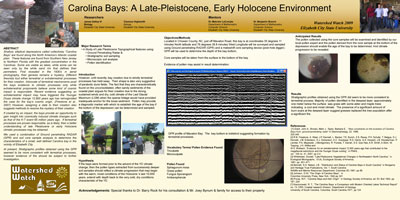
Shallow, elliptical depressions called collectively “Carolina Bays” are found along the North America’s Atlantic coastal plain. These features are found from Southern New Jersey to Northern Florida with the greatest concentration in the Carolinas. Some are visible as lakes, while some can be seen only by the white sand rim that defines their perimeters. First revealed in the 1930’s in aerial photography, their genesis remains a mystery. Different theorists tout either terrestrial or extraterrestrial processes for their creation. Advocate of terrestrial mechanisms posit the bays existence to climatic processes only while extraterrestrial proponents believe some kind of cosmic impact is responsible. Recent evidence suggesting an extraterrestrial impact may have triggered the Younger Dryas climate change 12,900 years ago has reinvigorated the case for the bay’s cosmic origin. (Firestone et al., 2007) However, assigning a date to their creation also suggests methods to resolve the mystery of their creation. If created by an impact, the bays provide an opportunity to gain insight into cosmically induced climate changes such as that of the K-T event 65 million years ago. If terrestrial processes are proven responsible, as is likely, then a better understanding of late Pleistocene or early Holocene climatic processes may be obtained. We used a combination of Ground penetrating RADAR (GPR) and soil core sample analysis to determine the characteristics of a small, well defined Carolina bay in the vicinity of Elizabeth City. At present, Stratigraphic profiles obtained using the GPR seemed to be more consistent with terrestrial processes, however evidence of fire should be subject to further investigation.
|
 |
| Monitoring Urban Impacts on Tree Growth - Mentors: Dr. Barrett Rock and Mr. Mike Gagnon (UNH) |
| Jason Paxton (COA), Anna Jackson (ECSU) |
 ABSTRACT ABSTRACT
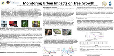
Our team studied the possible impacts of urban development on tree growth during the Watershed Watch Program. We focused on the science of dendrochronology and the effect of environmental factors on the trees. Tree cores and foliar samples were collected at the ECSU (Elizabeth City State University) campus, fig. 2, and compared with the same species from the Great Dismal Swamp (GDS) in Virginia, fig. 2. The main targets of this experiment are one aquatic tree, the bald cypress (Taxodium distichum) fig. 1, and a land based tree, the loblolly pine (Pinus taeda) fig. 3. This allowed us to compare an urbanized area with a more natural setting to determine factors impacting tree growth. This experiment did show us harmful impacts with the data that at ECSU. The growth rings of the ECSU campus tree cores are noticeably narrower, especially in the loblolly pine from the ECSU outdoor classroom, and multiple fluctuations in more recent tree rings of the bald cypress in the ECUS campus. VIRIS data provided evidence of chlorophyll disturbances that reflect the differences of the ECSU campus and the GDS and demonstrated greater abnormalities in the ECSU foliage samples of the chlorophyll due to much ground level ozone damage. |
 |
| The Effect of Sea Surface Temperature on the Strength of Major Hurricanes, Ivan and Katrina - Mentors: Dr. Jinchun Yuan (ECSU) |
| Justin Waddell (ECSU), Derek Graham (ECSU), Nicholas Tabron (ECSU) |
 ABSTRACT ABSTRACT
Hurricanes Ivan and Katrina were two hurricane that hit the Florida Keys, Gulf of Mexico and Louisiana area one year after the other. Ivan occurred in 2004 and Katrina became a hurricane in 2005. There are many factors that affect the strengths of these hurricanes. We obtained remotely sensed sea surface temperature and wind data of the Atlantic Ocean during hurricane Katrina and Ivan. By analyzing this data on Katrina and Ivan, we were able to compare the two storms. We believed that a hurricane’s wind speed was dependant upon the sea surface temperature along its track. |
 |
| Hurricane Impact on Trees - Mentor: Dr. Barry Rock (UNH) |
| Ashley Basnight (ECSU), Shiniqua Barrow (ECSU), Taylor Robinson (ECSU), Karmaria Whidbee (ECSU), Daquan Simmons (ECSU) |
 ABSTRACT ABSTRACT
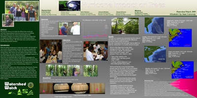
Our group’s focus is to study the effects that winds and saltwater impoundment from hurricanes, have on loblolly pines. Because trees are vital to maintaining world’s atmospheric balance, we need to know about the things that can negatively affect tree growth and could threaten future health. and life of trees. We will study trees and hurricanes in Northeastern North Carolina. |
 |
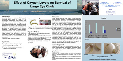
| Effect of Oxygen Levels on Survival of Large Eye Chub - Mentor: Dr. Kassim Traore |
 ABSTRACT ABSTRACT
Large Eye Chubs are freshwater fish frequently inhabiting small bodies of water in the southeastern United States. Small bodies of water are sensitive to rapid changes in oxygen levels. If fish are transferred from a high to low concentration of oxygen, they may suffer Hypoxia: this is low oxygen content in the organism. Oxygen is required in aerobic organisms for respiration and generation of energy required for metabolic processes. “It is important in a wide range of biological processes, such as animal hibernation and cell survival, and is particularly relevant in many diseases. The sensitivity of cells and organisms to hypoxic injury varies widely, but the molecular basis for this variation is not completely understood (Anderson, Mao, Scott and Crowder).” |
 |
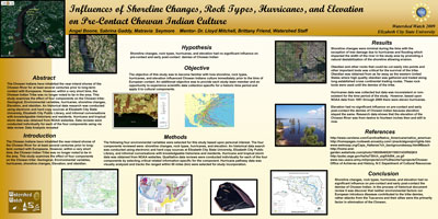
Influences of Shoreline Changes, Rock Types, Hurricanes, and Elevation on Pre-Contact Chowan Indian Culture
Mentors: Dr. Lloyd Mitchell (ECSU), Brittany Friend (ECSU) |
| Angel Boone (ECSU), Sabrina Gaddy (ECSU), Matravia Seymore (ECSU) |
 ABSTRACT ABSTRACT
The Chowan Indians have inhabited the near-inland shores of the Chowan River for at least several centuries prior to long-term contact with Europeans. However, within a very short time, the Chowan Indian Tribe was no longer noted to be in the area. This study examines the effect of four components on the Chowan tribe: Geological, Environmental variables, hurricanes, shoreline changes, Elevation, and obsidian. An historical data research was conducted using electronic and hard copy sources at Elizabeth City State University, Elizabeth City Public Library, and informal conversations with knowledgeable historians and residents. Hurricane and tropical storm data was obtained from NOAA websites. Data reviews were conducted individually for each of the four components using via data review. |
 |
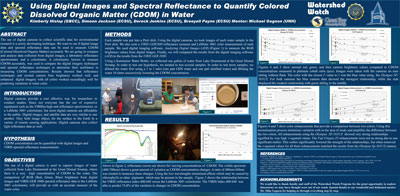
Using Digital Images and Spectral Reflectance to Quantify Colored Dissolved Organic Matter (CDOM) in Water
Mentor: Mr. Michael Gagnon (UNH) |
| Kimberly Hislop (GBCC), Simeon Jackson (ECSU), Dereck Jenkins (ECSU), Breeyell Payne (ECSU) |
 ABSTRACT ABSTRACT
The use of digital cameras to collect scientific data for environmental research is a newly developing technique. We want to see if digital image data and spectral reflectance data can be used to measure CDOM (Colored Dissolved Organic Matter) accurately We are going to compare and analyze data collected from digital images, a laboratory reflectance spectrometer, and a colorimeter. A colorimeter, known to measure CDOM accurately, was used to compare the digital imagery techniques and spectral reflectance techniques to determine their usefulness in measuring CDOM concentrations. Results showed that reflectance techniques and normal camera blue brightness worked well, and enhanced digital imagery with all colors worked exceedingly well for predicting variations in water color. |
 |
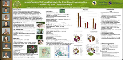
| Herpetofauna and Avifauna Diversity in the Great Dismal Swamp and the ECSU Campus - Mentors: Dr. Steve Hale (UNH), Mr. Chris Perry (COA) |
| De’lyncia Bethea (ECSU), Justin Paxton (COA), Arshaya Peterkin (ECSU), Joshua Rhodes (ECSU), Demaris Adams (ECSU), Elizabeth Hudson (GBCC) |
 ABSTRACT ABSTRACT
Research was conducted to compare the abundance and diversity of amphibians, reptiles, and birds in three separate locations within the Great Dismal Swamp (GDS) in Suffolk, VA and three locations on the Elizabeth City State University (ECSU) campus in Elizabeth City, NC. The preservation of these animals and their habitat is not only important to the eco-system but to human life because some of these creatures serve as bio-indicators for water and air quality. Additionally herps and birds help to keep mosquito and other pest populations in check.
|
 |
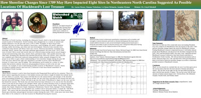
How Shoreline Changes Since 1709 May Have Impacted Eight Sites in Northeastern North Carolina Suggested as Possible Locations of Blackbeard’s Lost Treasure
Mentor: Dr. Lloyd Mitchell |
| Aaron Moore (ECSU), Simone Nicholson (ECSU), La’Quan Mclaurin (ECSU), Jasmine Hyman (ECSU) |
 ABSTRACT ABSTRACT
Shorelines in North Carolina, including the Albemarle Sound, which is the predominate inland sound located in Northeastern North Carolina, have changed due to a variety of natural and human influences over the past 300 years (1709 to 2009). Examples of these factors have included, but may not have been limited to hurricanes, canal dredging, silt runoff, vegetation burning, timber harvesting, and urban and rural development. Historical data searches were conducted using internet and library hard copy sources. Historical documents, including texts, drawings, diaries, marine logs, and maps spanning approximately 300 years from 1709 to 2009 were reviewed. More recent and current data was collected using existing remote sensed imagery and ground penetrating radar data, marine charts, geological maps, video graphic histories, and other data, including that obtained from informal discussions with local citizens. Data collected was compiled and collectively analyzed using qualitative tables uniquely designed for this project in an effort to gain a better understanding of how shoreline changes during the past 300 years may have affected the eight sites identified as possible locations where Blackbeardís treasure, if it does exist, may be hidden. This information can be useful for a variety of other studies that promote cultural, historical and geographical literacy as well as the arts and sciences. An example of such is determining possible locations of Blackbeardís treasure, which, according to popular literacy and local lore, is believed to have been buried somewhere in Northeastern North Carolina. |
 |
|
| |
|