


Research
The Elizabeth City State University (ECSU) Campus Map of Forest Types was successfully produced using remote sensing methods provided by MultiSpec data analysis, Landsat Enhanced Thematic Mapper ( ETM +) data (acquired 6/12/99 ) and aerial photographic data (acquired from ncOneMap ). |
|
Each Image used to produce the Elizabeth City State University Campus Map of Forest Types, including a description of each image, is provided below |
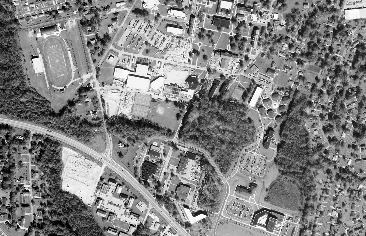
Aerial Photograph (ncOneMap)- This image is the aerial photographic image used to analyze and produce the final ECSU campus map of forest types. |
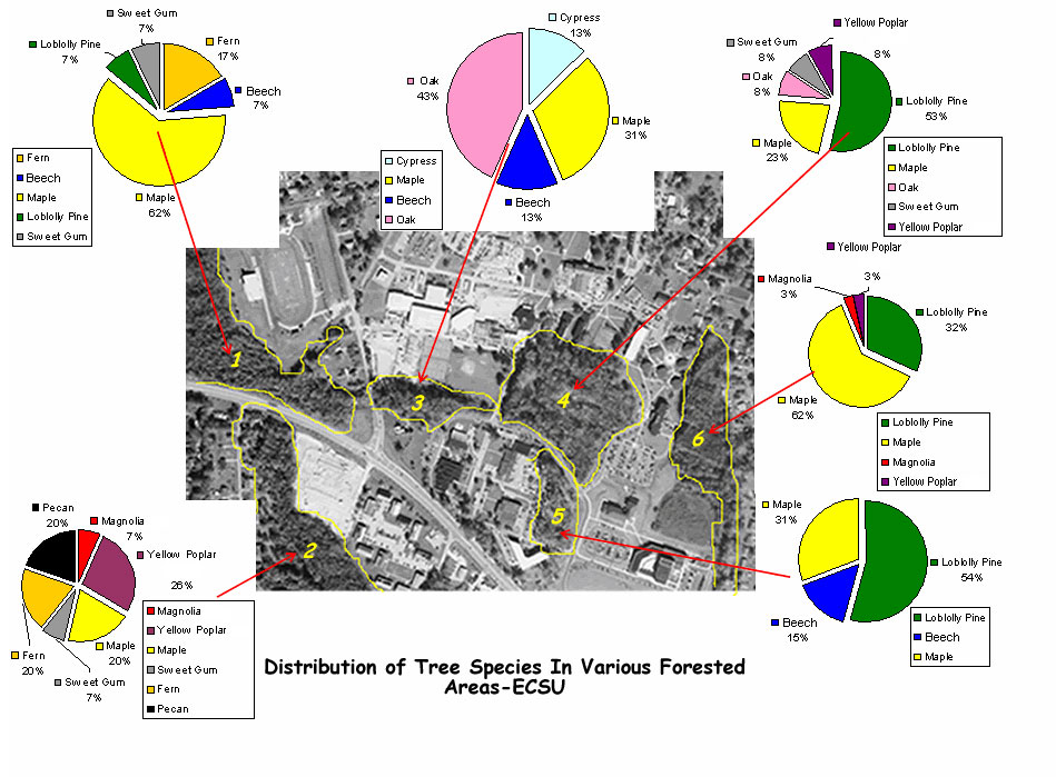
| ECSU Campus Map of Forest Types- This image is the final product that was produced by our team. It is a map that provides labeled charts of the distribution of tree species within the forest areas of the ECSU campus. |
| GPS Coordinates and Locations Legend- This legend is used to identify each area according to a designated number on the GPS map, Cropped Infrared Image, and the Unsupervised Classification (UC) Image. These sites were used for the justification of each forest parameter. |
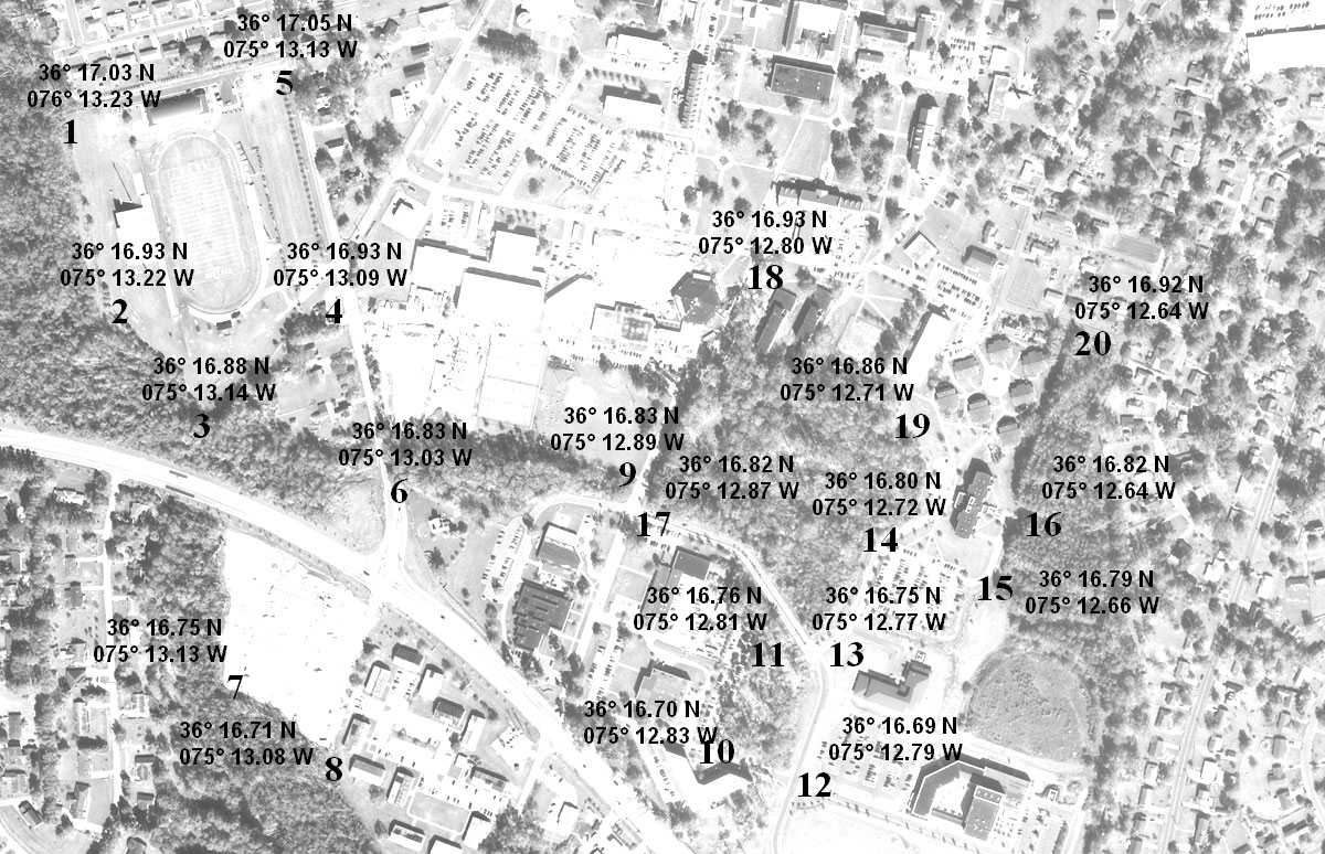
| GPS map- This image is the aerial photograph with labeled coordinates. The coordinates were derived through the use of a Global Positioning System (GPS). Using this image, our team was able to confidently assess the Unsupervised Classification. |
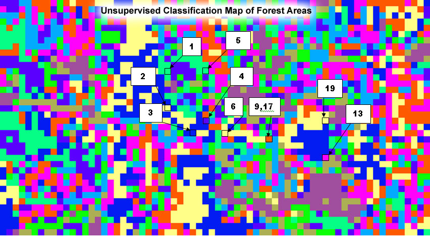
| Unsupervised Classification (UC) with GPS plots- This image provides several GPS plots for the justification of forest parameters. |
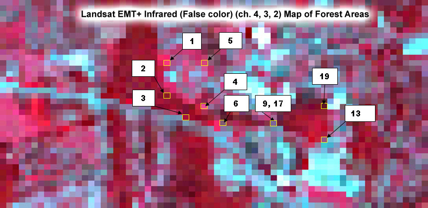
| Infrared Image with GPS plots- This image provides several GPS plots for the justification of forest parameters. |
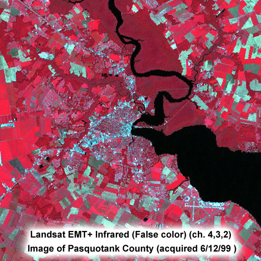
| Landsat EMT+ Infrared (False color) (ch. 4,3,2) Image of Pasquotank County (acquired 6/12/99 )- This image is the original image that provides 5 Thematic Mapper bands of reflectance level values using the new selection graph and Lat/Long provided by MultSpec . |
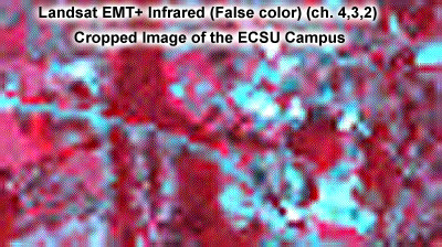
| Landsat EMT+ Infrared (False color) (ch. 4,3,2) Cropped Image of the ECSU Campus- This image was cropped from the original Pasquotank Infrared image to focus on the ECSU campus and its forested areas. |
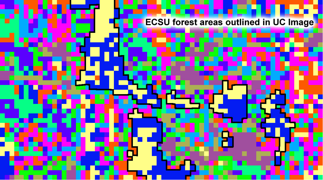
| ECSU forest areas outlined in UC Image- Each forested area is outlined in black to better distinguish the location and boundry of each forested area within the ECSU campus. |
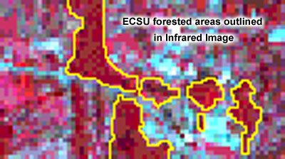
| ECSU forested areas outlined in Infrared Image- Each forested area is outlined in black to better distinguish the location and boundry of each forested area within the ECSU campus. |
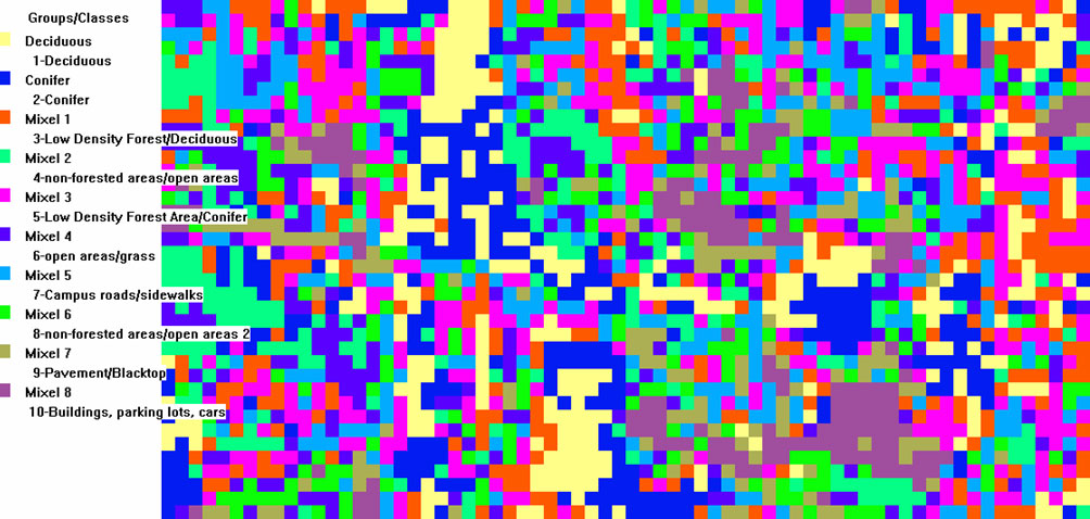
| Final Unsupervised Classification- This image is was produced using the GPS map, Cropped Infrared Image, and Pasquotank Infrared Image. The pixels contained in the image are grouped into classes based on the different reflectance levels. |