CERSER/IGARSS GPS Hands-On Training
Students received instructions on how to operate the GPS devices. They were then presented with the challenge of navigating to preselected local sites and recording data. Pairs of students used hand-held GPS to complete the tasks.
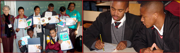
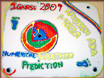 CERSER/IGARSS Remote Sensing Art Workshop CERSER/IGARSS Remote Sensing Art Workshop
Students provided a visual insight into how experiences at IGARSS‘09 had impacted them. Students visualized some of the highlights of IGARSS 2009 including registration, exhibits, people, posters, etc. Students designed an IGARSS 2009 mousepad and were judged on their creations. Mousepads and paints were provided by The ECSU Center of Excellence in Remote Sensing Education and Research (CERSER).
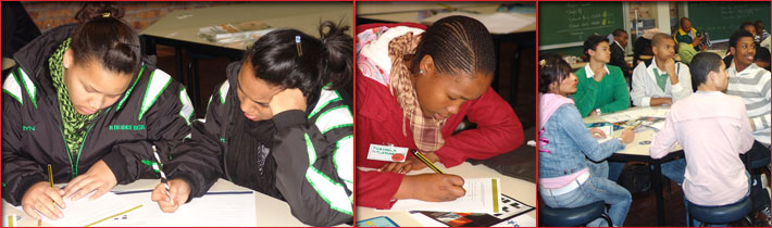
GEO/GOESS Mathematics of Remote Sensing Team Contest
Student teams brought their collective wisdom to the solution of mathematics problems related to remote sensing and climate change. Teams were challenged to solve 20 multiple choice mathematics questions. Awards were presented to each member of the winning teams.
IGARSS Scavenger Hunt
Students wrote four questions that they asked the scientist and vendors. They then took their questions to the Education-Outreach booth for approval and signature. Questions were asked about remote sensing or why they enjoy their job or what subjects are most important to study, what does a certain word or image mean, or what is the importance of remote sensing. Students then visited with vendor booths and met with scientists. They asked questions and got a signature. Rewards were provided for all who completed the IGARSS scavenger hunt.
IGARSS and You Photo Shoot
Students had their photo taken and printed on the cover of the IGARSS Education Outreach program flier.
NOAA Seminars
Nina Jackson of the National Oceanic and Atmospheric Administration conducted discussions and demonstrations of educational products for learners to help build understanding of the science of Earth’s systems and the stewardship of our planet.
- Operational Environmental Satellites: An overview of the NOAA operational environmental satellites, Geostationary Operational Environmental Satellites (GOES) and the Polar Orbiting Environmental Satellites (POES). After a short question and answer period, the students played the “GOES POES Wild World of Weather Adventure Game” prepared by the Jet Propulsion Laboratory (JPL) under contract to NASA & NOAA.
- Bathymetry, Topography and You: Discussion of the importance of satellite data and data measurement. After a short question and answer period, the students punched out, fold flaps, and created an icosahedron globe generated and prepared by the NOAA National Geophysical Data Center.
- Operational Environmental Satellites: An overview of the NOAA operational environmental satellite, Geostationary Operational Environmental Satellites (GOES). After a short question and answer period, the students constructed a mystery book of weather, space weather, and search and rescue prepared by the Jet Propulsion Laboratory (JPL) under contract to NASA & NOAA.
IGARSS Research Poster Session
Hundreds of research posters were on display related to themes that had a strong link to the development of the African continent, as well as themes that had international relevance. Authors were available at their posters for discussion of their research and to share their methods with the participants.
Earthzine Membership Drive
Earthzine kicked off its 2009 Student Essay Competition Sustainability through Earth Observation and Engineering. Representatives distributed the essay competition information and helped to sign up for an Earthzine membership.
|