The International Geoscience and Remote Sensing Symposium
IGARSS 2009
13th -17th July 2009
University Of Cape Town (UCT), South Africa
Prosper Yaw Adiku
University Of Ghana
Legon, Accra
IGARSS is a group of scientists involved in using Geosciences and Remote sensing applications in solving social, health and environmental problems. This year’s annual International Electronic and Electrical Engineers and - Geoscience Remote Sensing Society’s (IEEE-GRSS) Symposium was held in Cape Town- South Africa under the theme “Earth Observations- Origins to applications”
The symposium which came off between 12-18 July was designed to bring together IEEE-GRSS members basically to review past performances of the group in relation to achievements, drawbacks, strengths and the way forward into the future of the sciences. It is also an occasion that brings together professionals of various expertise from different continents and provides a common platform for sharing ideas and assisting young scientists develop in their respective areas of interest in the electrical and geosciences. The IGARSS 2009 of Cape Town is the first of its kind on the continent of Africa. Significantly, it is to encourage increased participation of African scientists in the Remote sensing industry thus presenting them and the continent as a whole with alternate means of solving the numerous socio-economic and developmental problems that plague the continent. For young African scientists like me, it was an important opportunity to meet many experts, interact with them leading to a reshaping of ideas and research interests in the field of remote sensing. It is also to help explore areas of collaboration in sharing scientific ideas, technology transfer and support.
At this conference, various activities were carried out and awards given to deserving professionals and students. Paper presentations research poster sections, seminars, exhibition of scientific findings, student paper competitions as well as most importantly, educational outreach programs were undertaken. An award night was organised to honour deserving students and professionals of the IEEE-GRSS fraternity in recognition of their hard work in moving the group to its current status of eminence.
Activities proceeded on daily basis under the supervision of a team leader. Activities of my team under the leadership of Dr. Linda Hayden proceeded on daily basis as summarised below:
MONDAY 13TH JULY, 2009
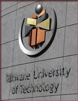 Visit to Tswane Institute of Technology (TUT) Visit to Tswane Institute of Technology (TUT)
The Tswane Institute of Technology (TUT) TUT was established on 1 January 2004, with the merging of the former Technikon Northern Gauteng, Technikon North-West and Technikon Pretoria. The objective of merging these institutions was to allow for the design of a better education system and enhance the standard of technical education in South Africa.
TUT has its campuses located in Tshwane (Pretoria, Soshanguve and Ga-Rankuwa), Nelspruit, eMalahleni (previously called Witbank) and Polokwane (previously called Petersburg). Students are from neighbouring states such as Botswana, Zimbabwe, Namibia and Swaziland.
The visit to Tswane Institute of Technology was carried out as part of the Igarss09 conference activities in exploring various avenues for collaboration in the area of remote sensing and GIS. The IGARSS team met the vice chancellor and principal of the Tswane University of Technology to discuss briefly deliberate on issues of collaboration and support.
Meeting the Vice Chancellor (VC) of TUT
A team of IGARSS members including other participants led by Dr. Linda Hayden paid a visit to the vice chancellor of TUT in Pretoria (now called Tswane) to interact with him on possible areas of collaboration. The team included NASA representatives, NOAA as well other university representatives and some student participants. The IGARSS team was accorded a warm reception by the vice chancellor and his team. The meeting was scheduled to serve as an opportunity for the two to formulate formal cooperation as well as explore further avenues for future collaboration and support in remote sensing applications and research.
According to the Vice chancellor, TUT came into been as a result of the restructuring of educational institutions in the 1990s to help them effectively churn out good products. This led to the merger of a number of schools leading to the creation of TUT with the emphasis on producing medical and science teachers.
The school has many faculties including education, science, humanities, Information Communication Technology (ICT) among others. When the V.C took his turn to address his guests on the difficulties of his institutions, he mentioned the lack of funds to finance the education of deprived but brilliant students as one of the problems faced by his institution and therefore welcomed any assistance in this direction.
 Speaking on some past collaboration, he said collaboration between France and South Africa has led to the creation of the French South African Institute of Technology (F’SATI) which is mainly concerned with the training of people in the use of technology in environmental design. This he said has led to an increasing use of telecommunication in environmental monitoring- nature conservation, determination of the evolution of sea surface temperature and its consequent impact on the fisheries as well as coastal states in relation to sea level rise and coastal erosion. Speaking on some past collaboration, he said collaboration between France and South Africa has led to the creation of the French South African Institute of Technology (F’SATI) which is mainly concerned with the training of people in the use of technology in environmental design. This he said has led to an increasing use of telecommunication in environmental monitoring- nature conservation, determination of the evolution of sea surface temperature and its consequent impact on the fisheries as well as coastal states in relation to sea level rise and coastal erosion.
The centre is also committed to using networked information in remote sensing. A visit was also paid to the FSATI unit to familiarise with on goings. The team then proceeded to the TUT campus that hosts the ICT unit located at Soshanguve.
At Soshanguve however, the Cooperative Education & Project Manager, ICT Innovation Enterprise Unit, Dr. Teddy T.F.Setshedi said the problem of TUT in terms of ICT development is not that of finance but human resource. He stated emphatically that “I would not complain of money to any one”. He said this when he was reacting to a question posed by the team in connection with difficulties in his institution. He said the school lack mentors/ lecturers in a number of areas and this has made it difficult for them to achieve their educational vision to the fullest. He further stated that the school has a number of well equipped facilities and more are being put up to enhance teaching and learning except for the problem of lack of professional human resource. He therefore called for assistance in exchange programs that would see some of the university lecturers in the team becoming instructors in his institution.
Opportunities for human resource development in the areas of IT, collaboration in the development of the students in various fields of study, opportunities for students willing to stud y in TUT were also presented.
In reaction to his submission, Dr. Dewayne Branch of the Elizabeth City State University who was also a member of the team assured Dr. Teddy T.F.Setshedi of his preparedness to help in whatever way he can. The team also expressed their preparedness to further cooperate to ensure a lasting relation that would yield useful results. Important contact information were therefore exchanged to that effect, a couple of which are presented below.
Contact Information
| Name |
Position |
Email |
| Prof. Yskandar Hamam |
Program Manager, Scientific Director (F’SATI) |
hamama@tut.ac.za |
| Prof. Errol M. Tyobeka |
V.C and Principal, (TUT) |
tyobekaem@tut.ac.za |
| Joyce Mashabela |
Deputy V.C. Finance and Business Development (TUT) |
mashabelagj@tut.ac.za |
| Dr. Teddy T. F. Setshedi |
Cooperative Education & Project Manager, ICT Innovation Enterprise Unit (TUT, Soshanguve campus) |
setshedittf@tut.ac.za |
TUESDAY (14TH JULY, 2009)
Paper and Poster Presentations
The day was full of activities including paper and poster presentations highlighting current scientific research findings. Opportunity was also offered to students and other young scientists to meet with experienced professionals and experts over lunch. Most of the papers presented focused on the use of remote sensing as a tool for development through improved agriculture and nature conservation.
Africa as a continent has high agricultural potential and a hub of natural resources. Effective management of these resources and the development of the agricultural potentials of the people to the fullest are therefore seen as the most effective means of improving the livelihood of the people and ensuring socio-economic development on a wider and rapid scale. Lack of effective resource management as well as under realisation of full agricultural potentials in most cases has been linked to lack of or inaccurate information with regard to resources. Remote sensing therefore provides an opportunity as an emerging area that can help in diverse ways to achieve the aforementioned objectives. Two of such papers presented were of a striking relevance in this direction. Summarise details of these papers are discussed below:
1. Synthetic Aperture Radar (SAR) Data Employed For Soil Moisture Estimation in Piketberg Region, South Africa.
This paper was presented by Jeanine Engelbrecht with support from The Council for Geosciences in South Africa. The paper described the use of remote sensing in quantifying the various parameters of the hydrologic cycle and the subsequent use of such information by water resource managers, for precision agriculture especially in view of the fact that those parameters are difficult to quantify in the field on larger scales being laborious and time consuming and lacking precision.
The paper described the Piketberg region located near Cape Town as a water scarce area but with an evidently high agricultural activity. The knowledge of soil water levels in this area would help in making effective decision with regard to which type of agricultural activity would thrive well in the area as most of this activity is rain fed. Knowing the water contents of each site would help decision makers to advice farmers in those regions on what types of plants are suitable to which areas.
The principle behind this research using the Synthetic Aperture Radar (SAR) data was based on the difference in scattering and dielectric properties of soils. There exists a sharp contrast between dry and moist soils in relation to their scattering and dielectric properties.
Three Environmental Satellite (ENVISAT) scanner data sets were used covering the period 2005 and 2006. One set was obtained in 2005 and two in 2006 respectively and these covered the beginning of the dry season, the dry season and the wet seasons respectively.
Processing methods such as linear regression between the soil surface moisture and the dielectric properties between wet and dry soils were analysed and computed. The information so obtained was compared to other available field information such as regional rainfall distribution for the area, vegetation cover and type, as well as height distribution of vegetation types. These were found to be consistent in correlation with the results obtained from other sources. Forests were found to have high moisture and height distributions thought to be as a result of the attenuation effect of the vegetation cover. The question was asked as to whether the regression correlations were related and she responded that they were highly related and as high as 14 (i.e.0.14).
In her concluding statement, Miss Engelbrecht recommended the use of this method for soil moisture classification using SAR data in view of its high sensitivity to soil moisture variability and dielectric constant between dry and wet soils. She however admitted its limitations in some areas and recommended the use of other methods such as the Dubois model in processing the data in order to improve upon its efficiency. She was hopeful that with the right resources to the South African Space Agency and the Water Resources Commission among others, the study can be carried out on regional scales for greater benefit to society within the sub-region and hopefully beyond.
2. Integration and Application of Remote Sensing Data towards the South African National Biodiversity Assessment.
This paper was presented jointly by Christoph Schultz, Mathieu Rouget, Nokuthula Wistebaar and Zuziwe Jones under the auspices of the South African National Biodiversity Institute (SANBI). This research looked at the use of remote sensing as a tool for prioritising areas of conservation needs, identifying critical areas in a practical systematic conservation planning program and its implementation. Identification of ecological and socio-economic hotspots is very important for conservation planning in a country such as South Africa where “about 80% of the land resources are in private hands”.
The above institution according to the presenter emerged from the Botanical Institute in 2004 as a result of an act (Biodiversity Act of 2004) with the view of incorporating all aspects of biodiversity into conservation as the Botanical Institute located in Cape Town was only dealing with plant conservation.
With the widening of the scope of conservation to include both plants and animals and other living natural resources, there is the need to consider an important aspect of conservation that is prioritising which areas need priority attention for conservation if the program is to succeed.
Accordingly, remote sensing can be used as a surrogate for conservation. The use of vegetation maps, land cover maps, biodiversity indices and socio-economic practices are some of the direct applications of remote sensing in natural resource management and planning. Indirectly, remote sensing can contribute to conservation through integration by helping in the management of terrestrial components, characterisation of terrestrial biodiversity, assessment of patterns and the prediction of change. Productivity among others can also be indirectly assessed through the use of data from Environmental Satellites, MODIS among others using spatial and temporal variations in various parameters of interest, a surrogate for productivity assessment.
Remote sensing according to the presenter can be used to identify endangered species habitat, socio-economic impacts on those species as well as their habitats and thus integrate the management of such human impacts on biodiversity into the management planning process of conservation.
SANBI at the moment is involved in the use of remote sensing integration in the management of its biological resources as well as offering advice to other regional and international bodies and institutions in this respect. It is the hope of the presenter that remote sensing applications would be increasingly integrated into the conservation process as a result of its wide applicability.
Poster Presentations
 Poster presentations focused on studies in ice sheets and the relevance of polar ice melting on the socio-economic activities of humans particularly on coastal states. The poster presentations were under the auspices of Centre for Remote Sensing Education and Research (CERSER), Centre for Research in Ice Sheets (CReSIS) and the Polar grid Project. Poster presentations focused on studies in ice sheets and the relevance of polar ice melting on the socio-economic activities of humans particularly on coastal states. The poster presentations were under the auspices of Centre for Remote Sensing Education and Research (CERSER), Centre for Research in Ice Sheets (CReSIS) and the Polar grid Project.
Some of the topics presented included:
Geopebbles: wireless sensor nodes for seismic monitoring of ice sheets by Jerome Mitchell, University of Kansas, United States, Peter Burkett and Sridhar Anandakrishnan both of the Pennsylvania State University in the United States.
Establishing a base camp for remote sensing of ice sheets in Illulissat, Greenland by Linda Hayden, Je’aime Powell and Eric Akers all of the Elizabeth City State University, United States.
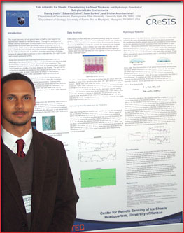
East Antarctic ice sheets: characterising ice sheet thickness and hydrologic potentials of sub-glacial lake environments by Randy Justin, Pennsylvania State University, Eduardo Cabret, University of Puerto Rico and Sridhar Anandarkrishnan, Pennsylvania State University, United States.
These presentations focused on ice sheets as having important relations to increasing sea level rise, coastal erosion and are constantly directly impacted by global warming. Ice sheets are also said to have some biological significance and might be responsible for the emergence of some new forms of life or species that have for years been locked up between huge stacks of frozen ice. The study of their thickness and lack forming potentials are necessary to know the rates of ice sheet depletion and the subsequent impacts this would have on humans and other life forms such as fish.
Importantly also is the need to develop effective means of safeguarding data obtained from the ice sheet regions in view of the nature of those regions in terms of climatic conditions and hence the cost involved in making even one trip. The presentation titled “Geopebbles: wireless sensor nodes for seismic monitoring of ice sheets” by Jerome therefore looked at effective means of developing sensors that are efficient for the purpose. The presentation described how radio transmitter units with efficient battery systems mounted with GPS can be used to effectively transfer data to a base station in place of the less efficient wireless system that was used initially. With high flexibility in seismic surveys while using this method, the presenter is hopeful that this method can be applied in constant monitoring of seismic activity while being applied to unfavourable conditions unaided.
Characterising ice sheet thickness would also help track changes to the ice sheets and help track effects of these changes on global climatic conditions. In this presentation, MATLAB and other softwares were used to manipulate remotely sensed data in looking for evidence of sub-glacial lakes. The research concluded that an evidence exist for potential sub surface lakes in those regions where the studies were carried out.
WEDNESDAY AND THURSDAY (15TH & 16TH JULY, 2009)
Educational Outreach, Minority Travel Program (MTP)
One of the most important activities of the conference was carried out on Wednesday and Thursday. This involved the educational outreach program designed for high school students and the MTP designed for student participants at the conference. The outreach program was aimed at introducing high school students to the concepts of remote sensing and how it can be applied in solving societal problems. The students who were drawn from several nearby high schools were made to understand some basic operations of satellites and other gadgets involved in gathering remote sense data and making meaning from such data.
To this extent, the students were taken through seminar presentations, GPS training sessions, remote sensing maths and arts contests. The students were also conducted round demonstration booths mounted by the various remote sensing organisations present at the conference. They were allowed to ask questions in connection with what they saw while going round the booths. They then wrote out their answers on a specially designed questionnaire for the purpose in a bid to enhance their understanding while ensuring that each student participated in the process. Art sessions organised required students to draw anything they see around the demonstration booths or posters that depict an idea in remote sensing. Prices in terms of certificates were awarded to students with the best art works. GPS training sessions were held to introduce the students to the idea of satellites and how they can help in obtaining data using hand- held Gamin GPS units.
Seminars were addressed by professionals from various institutions such as National Aeronautics and Space Administration (NASA), National Oceanic and Atmospheric Administration (NOAA) and university representatives.
The students were also allowed to have personal interactions with the professionals during a lunch session. The program was held for two days to ensure that it covers as many schools as possible. The students were also advised to develop themselves in areas that interest them and should not hesitate to enquire anytime they need to know about something. To this end an academic network with free membership named CERSER TO AFRICA website was launch to enhance the exchange of ideas between students and professionals.
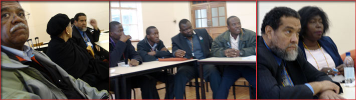
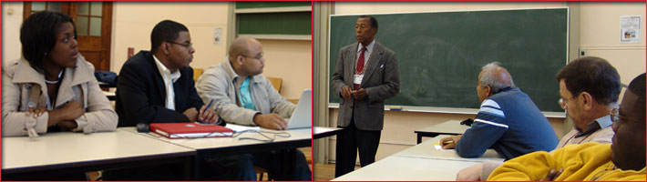
The MTP session was to allow enough interaction between professionals and student participants at the conference. This occasion was chaired by Dr. Charles C. Luther, the occasion was an interactive one that saw both professionals and students introduce themselves, their visions in the near future and what they want to contribute to society. The meeting also helped to reshape the ideas of some young scientists; other experienced professionals took turns to share their experience with the younger generation and challenged the younger generations to take advantage of available opportunities to help improve society.
Mrs Anna Gerald of NOAA students to be aware of the fact that every scientific information has applications to society. She further stated “our responsibility is to make our students know that we need all areas of discipline in our work” when she spoke on her own experience in using remote sensing and GIS applications and relating it to the multidisciplinary nature of remote sensing while recounting her own background as a social worker now involved in the use of remote sensing data.
Dr. Wiafe of the University of Ghana advised students to also focus on making good use of the opportunities that are available to them in their own countries in order to develop expertise and solutions that are applicable to the people within those regions they find themselves.
Speaking on opportunities available to students to undertake research and studies, Dr. Gilbert Rochun of Purdue University in the United States spoke of research opportunities with grants in his institution. Similarly, Dr. Linda Hayden of Elizabeth City State University’s Centre in Remote Sensing Education and Research (CERSER) spoke on summer exchange programs available to students with emphasis on the inclusion of African minority students.
Other participants present at the meeting included students from various universities in the US and from Africa as well as their professional representatives.
As the saying goes all work without play makes Jack a dull boy, a football gala was organised in the evening of Wednesday. It was a sight to withhold as “big time” professors and students alike took of their big coats and put aside their big books to flex their muscles in a friendly and keenly contested gala. Unfortunately however, no trophies or awards of any kind were awarded to the winners of the contest.
A banquet and an awards night were held on Thursday to reward deserving students and professional of the GRSS fraternity. Prizes were given to best paper presentations, winners of student paper competitions among others.
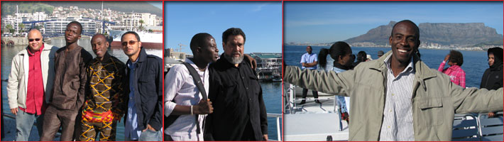
Friday was less active as most participants took the day off sight seeing being blessed by a beautiful sunny weather since the beginning of the program.
On the whole, the program has been a very successful one in which a high sense of team work was demonstrated. To this end the program has been able to open many students as well as industry players to new developments and offered the opportunities for sharing ideas and getting support.
I therefore credit the organisers of this year’s IGARSS conference for a great job well done. Congratulations!!
|