|
Determination of an Empirical Model Relating Canopy Cover to NDVI Values in the Pasquotank Watershed, NC
Abstract
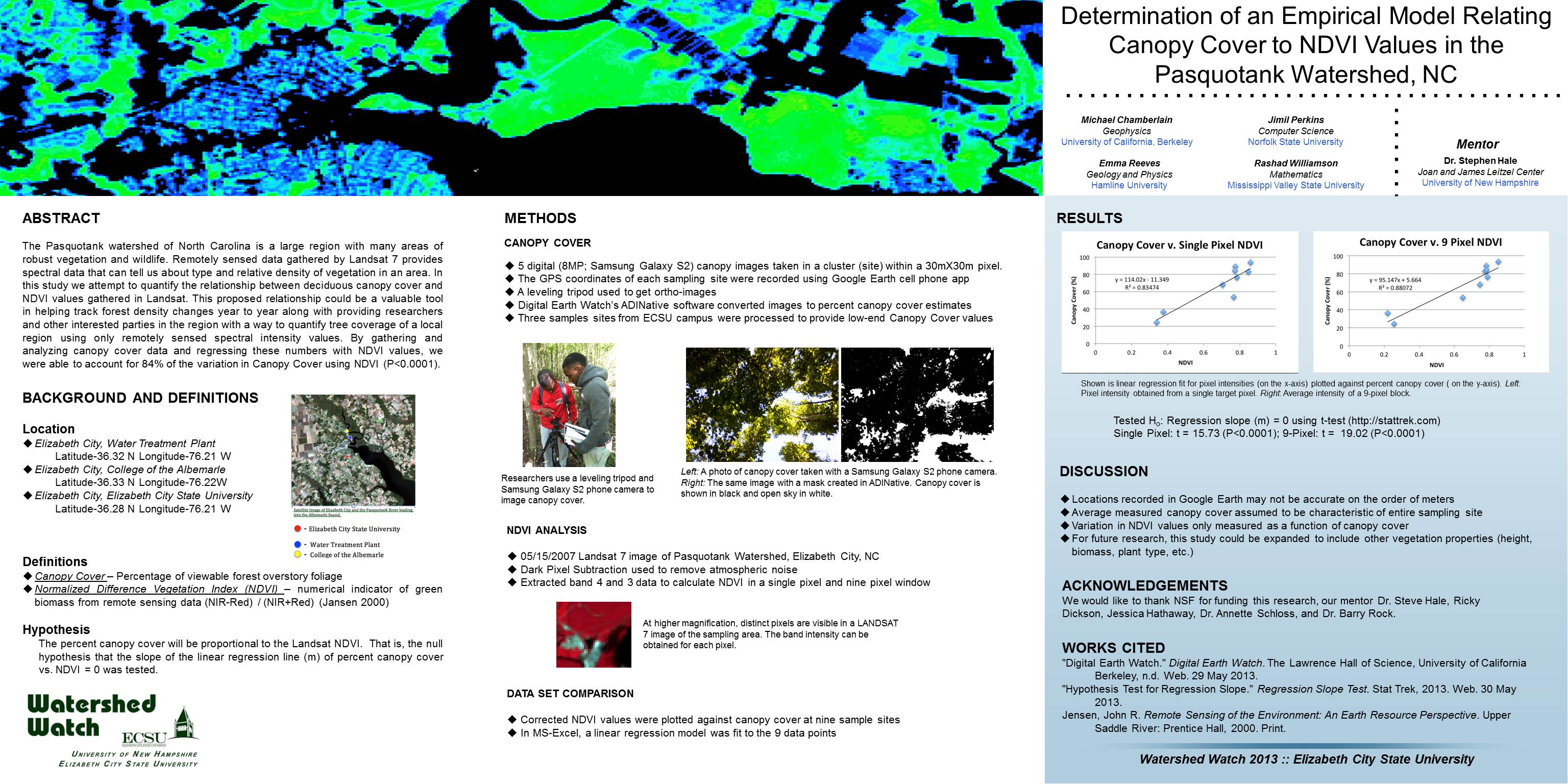
The Pasquotank watershed of North Carolina is a large region with many areas of robust vegetation and wildlife. Remotely sensed data gathered by Landsat 7 provides spectral data that can tell us about type and relative density of vegetation in an area. In this study we attempt to quantify the relationship between deciduous canopy cover and NDVI values gathered in Landsat. This proposed relationship could be a valuable tool in helping track forest density changes year to year along with providing researchers and other interested parties in the region with a way to quantify tree coverage of a local region using only remotely sensed spectral intensity values. By gathering and analyzing canopy cover data and regressing these numbers with NDVI values, we were able to account for 84% of the variation in Canopy.
http://nia.ecsu.edu/ww/summer13/wwposters-2013/multispec.jpg

|

