UML Class Diagrams of PRISM Multi-Agent Subsystem Using XML and FIPA
Goals
 Scientists and engineers at the University of Kansas are applying their expertise to develop and utilize innovative radar and robotic rovers to measure ice thickness and determine bedrock conditions below the ice sheets in Greenland and Antarctica. They are doing this through the auspices of a grant from the National Science Foundation (NSF) and NASA. This grant has been named PRISM (Polar Radar for Ice Sheet Measurements).
The Reason
The data collected and the technology developed will enable researchers to do three things: a) determine the presence or absence of a film of water between the ice and the bedrock; b) measure ice thickness and c) map internal layers in both shallow and deep ice. The measurement of water at the bedrock level (basal water) is important because basal water lubricates the ice/bedrock interface and makes it easier for the ice to flow toward the ocean. Data on near-surface internal ice layers will be used to estimate the average, recent accumulation rate, while the deeper layers provide a history of past snow accumulation and flow rates. This combination of data will help earth scientists determine more unambiguously how quickly the polar ice sheets are melting and to make more accurate predictions of the effects of this melting on sea level rise. Scientists have postulated that excess water is being released from polar ice sheets due to long-term, global climate change; but there are insufficient data to confirm these theories. Understanding the interactions between the ice sheets, oceans, and atmosphere is essential to quantifying the role of ice sheets in sea level rise. This, in turn, allows earth scientists to more accurately predict the probability of significant sea level rise. A significant sea level rise would have a devastating impact on world population, agriculture, and ecosystems since nearly 60% of the world's population lives in coastal regions which would become flooded. "
The Plan
PRISM scientists plan to use synthetic aperture radar carried on ground level rovers to map the polar ice sheets and the bedrock. Ground-level radar of this type will provide a 2-D picture and more details than have previously been available from satellite imagery and airborne SAR radar. This radar will be able to operate in either monostatic or bistatic mode in order to produce the detail needed by glaciologists. Much of this project will focus on developing new technologies needed to carry out the project. These new technologies include development of an "intelligent" and "collaborative" radar system; that is, one that can look at the data it is generating in real-time, determine if these data indicate that an area should be studied in more detail and then send that information to another radar system which is taking similar measurements only a few kilometers away. PRISM engineers also need to design and build a semiautonomous ground rover capable of: a) withstanding the rigors of the polar environment, b) towing the radar safely and accurately, c) providing power for the radar systems and data analysis systems as well as the rover, and d) keeping track of the exact position of the radar units at all times. PRISM scientists will also be developing a wireless communication system that operates in harsh polar environments to allow the rover and radars to communicate with one another as well as transmit near-real-time data back to other researchers and educators in distant locations.
General Procedures
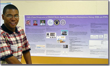
The investigator worked with the Intelligent Systems team by transposing the codebase (Java) to get an understanding of the basic issues involved in the design and implementation of a multi-agent system. Using the PRISM codebase, the investigator was given an understanding of the multi-agent system and contributed to the PRISM project by creating Unified Modeling Language (UML) models with eXtensible Markup Language (XML) and the Foundation for Intelligent Physical Agents (FIPA) regulations. Because there are many UML diagrams, the investigator chose the class diagrams to represent how agents respond to different requests and provide necessary data to satify a heterogenous task. With these models, the PRISM Intelligent Systems team can plan modifications and addition to the multi-agent system. The models will help plan for additional functionality for next years field tests.