Abstract
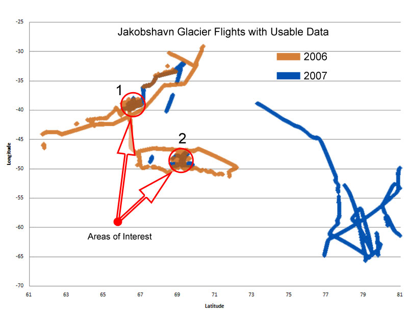
The Center for the Remote Sensing of Ice Sheets (CReSIS) has been compiling Greenland ice sheet thickness data since 1993. The airborne program utilizes a 150 MHz radar echo sounder to measure the ice thickness. This data is currently available on the CReSIS site (http://www.cresis.ku.edu) in various formats including PDF, Matlab, and plain text files. These formats are not readily usable in the classroom environment as a visual representation of the ice depths for each expedition.
The URE 2009 Greenland Team will undertake the task of compiling the data in these files by year and then verifying the format of the data. The data will then be analyzed statistically for calculated , missing, and actual depth readings. The team will utilize a scientific data visualization software package to present the data via the web to elementary, undergraduate, and graduate students for research and education. |
 Center for Remote Sensing of Ice Sheets