Poster |
||
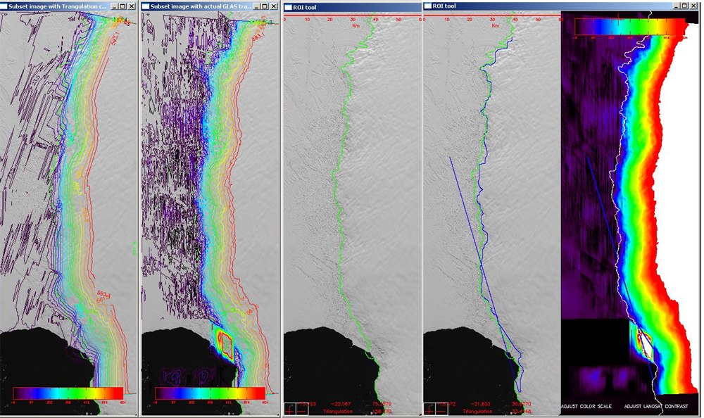
In support of a larger NASA International Polar Year (IPY) project to determine the Antarctic’s mass balance (i.e. net gain or loss of ice from the Southern continent, the task was to determine the ‘Grounding Line’ along a specific stretch of the Antarctic Coastline; using NASA supplied computer codes written in Interactive Data Language (IDL), installed and ran in the windows environment. The mass balance is the difference between the snow that is accumulating inland and the melting that is occurring at the margin of the ice sheet. The grounding line defined for the basis of our project is to determine the extent of the grounded ice that is now available for melting (and might be available to raise sea level), and to help determine the amount of melting that is occurring. Using LANDSat Imagery and ICESat Laser Altimetry, images of the continent were made available through the Landsat Image Mosaic of Antarctica (LIMA) project on the U.S. Geological Survey website. LIMA uses cloud free images to map the continent in great detail. ICESat (GLAS data) was provided for the purpose of the training, whereas the actual ICESat/GLAS data was downloaded from the National Snow and Ice Data Center website. These images were utilized in the final production of the grounding line. |
||