
 CTIC TEAM 2015
| Home | Abstract | Research | Team Members | Links |
|
||||||||
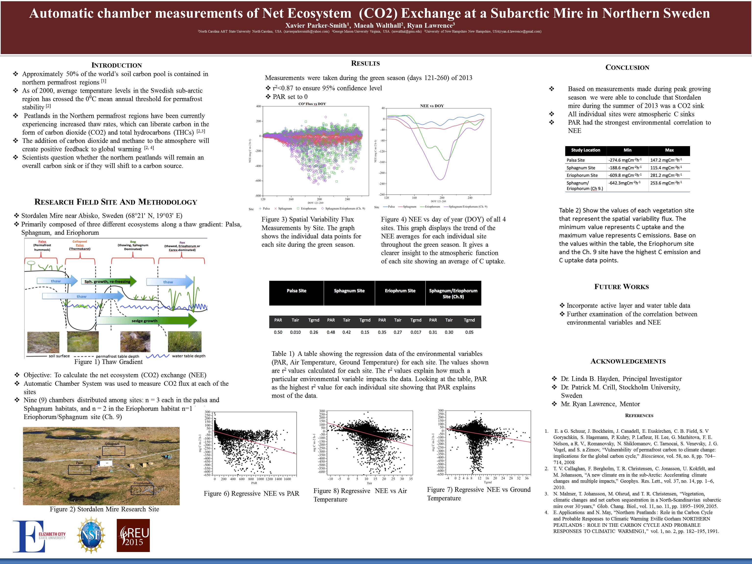
Permafrost is described as cryotic soil below a top layer of soil known as the active layer. Most of the the world's permafrost can be found in northern hemisphere at high latitiudes. In the past 100 years, there as been a signigicant increase in the earth' s temperature. With polar climates warming, permafrost underlain in northern wetlands have bagun to thaw at a rapid rate. As the permafrost thaws, organic carbon that has been stored in the deep soil is emitted to the astmosphere causeing a positive feedback to global warming and altering the landscape of the sub arctic wetlands. Storadlen Mire, a subarctic peatland located in northern Sweden has been an area of study for years in the impact of permafrost degredadtion. The diagram(Adapted from Johansson 2006) below shows the transformation between the three dominant vegetation sites at Stordalen (Palsa, Sphagnum, and Eriophorum) due to permafrost thaw.
The purpose of this research was to analyze data from Stordalen Mire, generated by the automatic chamber system, to conclude whether the peatland is still a atmospheric sink or shifted into a atmospheric source. Data from the green seaon was the main focus. The team took into account the evironmental conditions such as photosynthetic active radiation (PAR), air and ground temperature.
|
||||||||

| :: Center of Excellence in Remote Sensing Education and Research | ECSU | 1704 Weeksville Road | Elizabeth City, NC 27909 :: |
| ONR - URE/OMS N00008-1-0832 NSF REU ANT-0944255 CReSIS - NSF FY 2005-108CM1 |