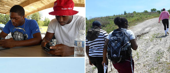
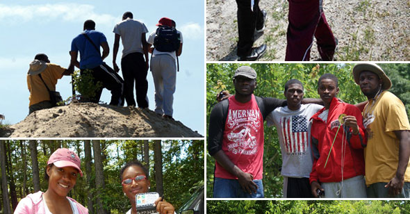
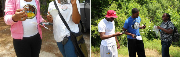
Students’ used Geographical Information Systems (GIS), Global Positioning System (GPS), and other remote sensing tools to view the Earth, its systems, and its inhabitants in a whole new light.component that offered middle school students hands-on experience with remote sensing and its applications. Specifically, participants received training with Global Positioning Systems (GPS) where the students learned the tools, mechanisms, and applications of a Garmin 60 GPS. As a part of the program the students were required to complete a field work assignment where several longitude and latitude points were given at Fun Junction park in Elizabeth City, NC. The students had to then enter the longitude and latitude points into the Garmin 60 GPS, navigate their way to each location while also accurately reading the GPS to make sure they were headed in the right direction. Upon completion of the training the students were able to understand the function of a GPS, how to analyze and comprehend longitude and latitude points, and the importance of GPS devices in real world applications
The Global Positioning System (GPS) is a space-based satellite navigation system that provides location and time information in all weather conditions, anywhere on or near the Earth where there is an unobstructed line of sight to four or more GPS satellites. The system provides critical capabilities to military, civil and commercial users around the world. It is maintained by the United States government and is freely accessible to anyone with a GPS receiver.
The GPS project was developed in 1973 to overcome the limitations of previous navigation systems,[1] integrating ideas from several predecessors, including a number of classified engineering design studies from the 1960s. GPS was created and realized by the U.S. Department of Defense (DoD) and was originally run with 24 satellites. It became fully operational in 1994. |