|
|
|
|
Abstract
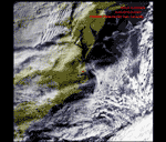
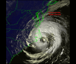
The remote sensing field has seen an increase in the availability of data. There has been an increase in the satellites that have been launched and those scheduled to launch. With the increased availability of data and advancements, satellite data providers are able to supply researchers with the data needed to conduct new and innovative projects. SeaSpace, based in California, has designed TeraScan, a system for reception and processing of satellite data. During July 2002 a TeraScan system was installed on the campus of Elizabeth City State University. Its capabilities include receiving and processing hrpt and swcrpt data from polar-orbiting satellites NOAA and Orbview-2. As an ongoing project, the Remote sensing Research Team for 2003 will process hrpt data from the NOAA satellite and decrypt and process SeaWifs data from the OrbView-2 satellite. Image processing will include correcting noisy data, calculating sea surface temperature, and calculating NDVI (Normalized Vegetation Index). This project will lay the foundation for future projects by providing the necessary experience and training with the TeraScan data and Software.
|