 Workshop Workshop
The 21st Annual HBCU Summer Faculty GIS Workshop provided the basic training
needed to utilize GIS in the academic environment for teaching, analysis
and grant research. Over 20 years ago, the U.S. Geological Survey with
the National Parks Service began a summer workshop to train less than
a dozen HBCU faculties in GIS. Since 1999, Howard University Continuing
Education's Urban Environment Institute has expanded the summer workshop
with funding from various agencies and the partnership of numerous companies.
Government agencies generate nearly a third of all GIS sales of technology
products and services and greatly need GIS services. Over 40 or a third
of all HBCU's have had faculty trained at this summer workshop.
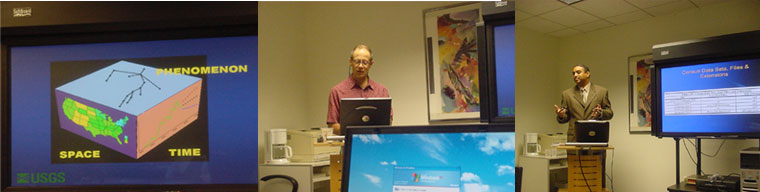
GIS
Geographic Information Systems or GIS is a particular kind of ' software
that runs like a database program that contains information about places,
and physical features that can be linked to places. GIS is also a specialized
field where people build geographic databases, perform analyses and create
maps. People live, work, and play somewhere and GIS can show you where
and information about them and their communities. |