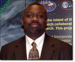
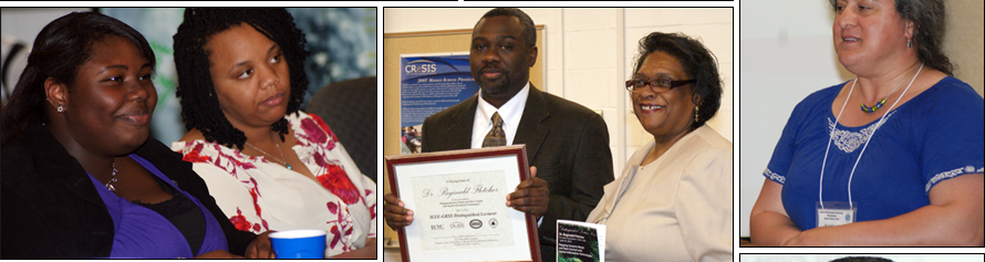
 On Thursday, April 19, 2012, Dr. Reginald Fletcher of the USDA-Agricultural Research Service (ARS) in Weslaco, Texas presented "Mapping Invasive Weeds and Their Control with Spatial Information Technologies" as part of the continuing Distinguished Lecture Series sponsored by the IEEE-Geographic Remote Sensing Society. Dr. Fletcher is a soil agronomist studying the science of utilizing plants for food, fuel, feed, and fiber. On Thursday, April 19, 2012, Dr. Reginald Fletcher of the USDA-Agricultural Research Service (ARS) in Weslaco, Texas presented "Mapping Invasive Weeds and Their Control with Spatial Information Technologies" as part of the continuing Distinguished Lecture Series sponsored by the IEEE-Geographic Remote Sensing Society. Dr. Fletcher is a soil agronomist studying the science of utilizing plants for food, fuel, feed, and fiber.
Dr. Fletcher's research interests focus on the applications of airborne multispectral digital imaging systems, imaging processing techniques, global positioning systems (GPS), and geographic information systems (GIS) for mapping the invasive weeds giant salvinia (Salvinia molesta) and Brazilian pepper (Schinus terebinthifolius) and for monitoring biological control of saltcedar (Tamarix spp.), in Texas. A list of his projects and publications can be found at: http://www.ars.usda.gov/pandp/people/people.htm?personid=1757.
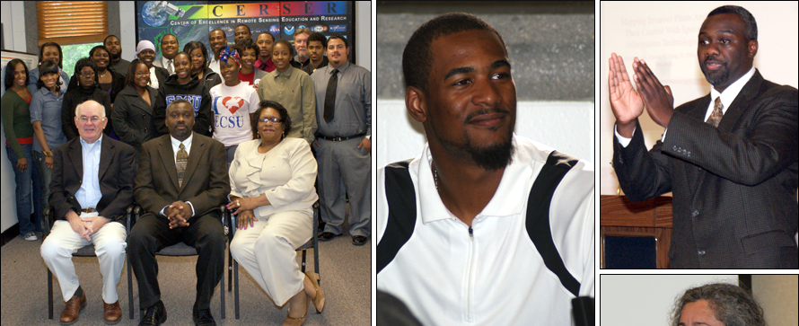
The meeting was opened by Mr. Je’aime Powell who also read the minutes from the last ECSU-IEEE GRSS meeting. Autumn Luke made a motion to accept these minutes and Ryan Lawrence seconded them. The final presentation of the Undergraduate Research Experience teams was made followed by an introduction of Dr. Fletcher by Dr. Gulnihal Ozbay of Delaware State University.
View the Program for the event here:
http://nia.ecsu.edu/ur/1112/120419dls/program_Spring12_DLS.pdf |
 |
 |
|
Lecture Title
Mapping Invasive Weeds and Their Control with Spatial Information Technologies
ABSTRACT
We discuss applications of airborne multispectral digital imaging systems, imaging processing techniques, global positioning systems (GPS), and geographic information systems (GIS) for mapping the invasive weeds giant salvinia (Salvinia molesta) and Brazilian pepper (Schinus terebinthifolius) and for monitoring biological control of saltcedar (Tamarix spp.), in Texas. An airborne six-camera multispectral digital video imaging system and an unsupervised image classification approach were used to map the invasive water weed giant salvinia in a bayou in northeast Texas. User’s and producer’s accuracies for the giant salvinia class were 74.6% and 87.2%, respectively. An airborne five-camera multispectral true digital imaging system and a supervised classification image approach were employed for mapping the invasive terrestrial plant Brazilian pepper at a resaca in south Texas. User’s and producer’s accuracies for the Brazilian pepper class were 100% and 84.2%, respectively. During 2010 and 2011 in west Texas, a medium format true digital color camera was integrated with GPS and GIS technologies to monitor biological control of saltcedar with the saltcedar leaf beetle (Diorhabda spp.) and to track beetle movement. Foliage of saltcedar trees with moderate damage caused by beetle and larvae feeding appeared in distinctive orange and brown color tones on the airborne imagery; defoliated trees had dark gray color tones on the imagery. The camera was tethered to a GPS that recorded the coordinates of the center of each frame and saved this information into an exif file. Coordinate information obtained with the GPS was used to derive a map showing the locations of trees damaged by the beetle. Technologies employed in these studies are promising tools that natural resource managers can use now and in the future to map invasive weeds and to monitor biological control of invasive plants.
|
|

 Center of Excellence in Remote Sensing Education and Research