|
| October 9, 2007 |
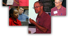
| The Elizabeth City State University Distinguished Lecture Series continued with the welcoming of Dr. Lee De Cola, a Research Scientist at the U.S. Geological Survey in Reston Virginia. This lecture was sponsored by the ECSU School of Mathematics, Science and Technology and hosted by the Center of Excellence in Remote Sensing Educationa and Research (CERSER). |
 |
Dr. De Cola has degrees in mathematics and in regional planning from the University of California and in geography from the University of Ibadan, Nigeria. He is currently using graph theory to study the geography of human health risks and the spatial structure of land cover data. He has published on such topics as: the geography of disease and health services, urbanization in Africa, fractal analysis of land processes, dynamic mapping of urban systems, and the geography of knowledge. He is an adjunct faculty member at George Mason University, and has taught at the Universities of Ibadan, Southern California, and Vermont, as well as at Boston, West Virginia, and Georgetown Universities. He also participates in geographical information science training activities with Historically Black Colleges and Universities. |
|
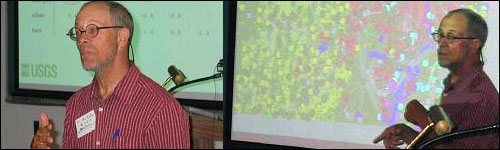
| Dr. De Cola's lecture was entitled "Using Graph Theory to Model Land Cover" which described his work on ways of simplifying land cover maps using graph theory. When pixels next to one another have the same land cover they show up on maps as “patches” with the same color. These are represented using largest patches as points located at the center of the patch, and if two patches touch one another this is shown as a line between the points. This “graph” of points and lines is a drastic simplification of the land cover map that nevertheless retains a great deal of the information within it, including location, land cover type, and adjacency. But the graph also adds new information by explaining which kinds of landscapes tend to have many neighbors, which pairs of land cover types tend to be near one another, and what kinds of land cover types are fragmented. This information can be integrated with other graphs that represent such phenomena as 1) animal migrations and invasive species, 2) stream networks, 3) road systems, and even 4) the spread of infections. |
 |
|