| This
project represents a joint effort by the North Carolina Department
of Fisheries, The National Oceanic and Atmospheric Administration
(NOAA), Elizabeth City State University, The MU-SPIN Office of Goddard
Space Flight Center, and The Naval Research Office of Remote Sensing
and Space. It is the intent of this project to exposed HBCU students
to DOD, NASA and NOAA research and to develop innovative and relevant
research collaboration focused on coastal, ocean and atmospheric research.
Academic
Year Program
The project involves the design of an academic year research project,
which cross references sea surface temperature data, which is concordance
with Turtle Catch Long Line data from the National Fish Service
and NOAA's National Marine Fisheries Service. During the academic
year students from Elizabeth City State University will be actively
involved in processing of the data and posting of results.
Training of
undergraduates through research, field work and observations is
imperative in the university's goal of producing quality students
well prepared to enter graduate school or to pursue careers in ocean,
marine and atmospheric science. These undergraduate research projects
will go a long way towards making these goals a reality.
Summer Undergraduate Research Experience in Ocean, Marine and Atmospheric
Science Program
During the summer of each year an 8-week undergraduate research-training
program will be conducted at ECSU, which will involve undergraduate
students, from universities across the nation. Visiting lectures
during the academic year and summer will involve scientist from
all the collaborating agencies
The objective
is to encourage careers in ocean, marine and atmospheric science;
and to promote the professional development of minority undergraduates
through their participation in ongoing wetlands, ocean and marine
science research within the coastal environment of northeastern
North Carolina.
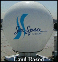 SeaSpace
TeraScan Remote Data Sensing System SeaSpace
TeraScan Remote Data Sensing System
To support the program, SeaSpace and ECSU have provided a SeaSpace
TeraScan SeaWiFS system. SeaSpace is the world's leading weather
information provider. The TeraScan SeaWiFS and HRPT system is composed
of the following components: Polar Orbiting Tracking Antenna (1.5m);
Global Positioning System (GPS) Antenna/Receiver; Telemetry Receive;
SGP Interface Unit (SGPI); Uninterruptible Power Supply (UPS); and
the TeraScan Software Suite.
The
TeraScan
system provides Advanced High
Resolution Radiometer (AVHRR)
and Sea Viewing Wide Field
of view sensor (SeaWifs)
data from Polar Orbiting
Satellites.
|
|
|
|
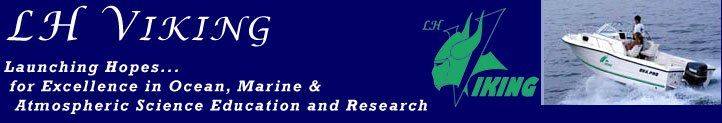
The LH Viking
Water Vehicle
Sea Pro Model 210 Fiberglass boat and trailer with:
¨ UHF Radio
¨ Raytheon 300 GPS
¨ Raytheon 365 Depth Finder
|
|
Funded
Through
NASA Grant #NCC5-0533
NASA Grant #NAG5-9371
NASA Grant #NAG5-9372
ONR Grant #N00014-11-0529
ONR Grant #N00014-01-1070
NOAA Agreement #41-AA-NE-111238
|
|
For
More Information
(252) 335-3696 voice (252) 335-3790 fax
|
|
|
|
Research
& Training Projects
****
Coastal Ocean Observations:
Correlation between AVHRR SST Data with the Presence of Sea Turtles
(Dr. Linda Bailey Hayden, PI)
****
The CoastWatch Data Validation Study
(Dr. Linda Bailey Hayden, PI)
****
Undergraduate Research Experience in Ocean, Marine & Atmospheric
Science
(Dr. Linda Bailey Hayden, PI)
****
NASA Network Resources and Training Site
(Dr. Linda Bailey Hayden, PI)
****
NASA You Be The Scientist With Satellite Imagery
(Dr. Linda Bailey Hayden, PI)
****
NASA Mathematics of The Great Dismal Swamp
(Dr. Linda Bailey Hayden, PI)
****
Impact of Intense Noise in the North Carolina Coastal Waters
on Sea Turtles
(Dr. Linda Bailey Hayden, PI, Mrs. Liz Noble, Co-PI)
****
Seasonal Changes in Phytoplankton Concentration in the Albemarle
Sound
Using
the Sea WIFS Satellite Images
(Dr. Francisco San Juan, Jr., PI)
****
Remote Sensing Classification and Time Change Analysis of the
Wetlands of the Albemarle Sound
(Dr. Francisco San Juan, Jr., PI)
****
Pasquotank Water Quality Project
(Dr. Maurice Powers, PI)
****
A Geographic Study of Marine Life in the Local Waters in Northeast
North Carolina to Promote Student Research in Remote Sensing
(Dr. William Porter, PI)
****
ARCVIEW/GIS Software as a Tool for Evaluating Coastal Populations
(Dr. William Porter, PI)
****
Validation of LITE Tropospheric and Stratospheric Temperature
Measurements
(Dr. Ali Omar, PI)
****
|
|