2001 Summer Internship Abstracts

Ramatoulie Bah | Shayla Brooks | Torreon Creekmore | Vincent Davis | Willie Gilchrist
Paula Harrell | Travis Jennings | Melvin Mattocks | Golar Newby | Elizabeth Rascoe
Carl Seward | Eunice Smith | Nelson Veale | Ernest Walker

Return to ONR


Back to Top
Researcher: Ramatoulie Bah, Junior/Physics/Computer Science
Mentor: Dr. Daniel Smith
Internship: South Carolina State University
Title: Clustering of Galaxies
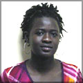
The research project was to demonstrate how layering of galaxy clusters takes place in a universe using Mathematica sofiware, which allowed us to demonstrate overlapping of the galaxies in each layer of cell in the model universe.

Within the model of galaxy clustering, galaxies were randomly chosen to image this model. A number of galaxies were given by their location that had been identified by rows and columns. These galaxies filled a fraction of the universe that initialized dimensions of the universe. While the universe expands, the radius of the horizon expands. The model has given a number of galaxies, and a number of cells to be filled randomly. If a random cell is already filled, the program chose another cell that is empty in close neighboring distance to the chosen galaxy.

A model universe with galaxies in them was created . Placing each galaxy in separate cells, they eventually formed into clusters due to the massiveness of the galaxies, with respect to their mutual gravitational attraction. However, the big question of our research was, how to make the galaxies overlap forming layers on top of each other.

When you have galaxy clusters that means that those galaxies are in the neighborhood of each other. So if we just put together a bunch of galaxies, then it would be a mess because we wouldn't know what is in the neighborhood of what. This would totally defeat the purpose of our project.


Back to Top
Researcher:
Shayla Brooks, Junior/Computer Science
Mentor: Dr. Cheryl Lewis
Internship: Ronald E. McNair Program at Elizabeth City State University
Title: Using Computer Programming to do DNA Sequence Analysis
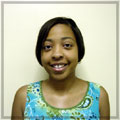
Initially, the investigator addressed the fundamentals of DNA Sequence Analysis, including its importance and the kind of information that can be learned from DNA Sequences. The investigation began with molecular biology and the basic principles and practices of genetics. The major portion of this investigation addressed the DNA Recombinant Revolution and DNA Sequence Analysis. According to the fifth edition of the Glossaiy of Genetics, DNA Sequence Analysis is "a routine analytical procedure for investigation of the phyogenetic relationship of organisms, the diversion of multigene families, and the evolution of gene structure", used to detect mutations linked to various diseases such as cystic fibrosis. Put in simple terms, DNA is a polymer and it is made up of monomer units called nucleotides (bases). There are four different types of nucleotides found in DNA. They are given one-letter abbreviations as shorthand for the four bases. A is for adenine, C is for guanine, C is for cytosine, and T is for Thyrnine. The molecules of DNA consist of a sequence of rnillions of these characters, somewhat like a necklace in which each pearl can be one of 4 possible colors. The order of the nucleotides in each sequence is the way the biological information is stored.

An example of a short DNA sequence is:
Aaacaaaatg gttgagaaac acggctctaa actcatgtaa agagttcaag aaggaaagca aaaacagaaa tggaaagtgg tccagaagca ttaagaaagt ggaaatcagt atgttcccta tttaaggcat ctgcaggaag caaagccttc agagaaccta gagcccaagg ttcagagtca cccatctcag caagcccaga agcatctgca atatctatga tg

The investigator identified! developed a variety of computer programs that can be used for identifying and recognizing various patterns in DNA Sequences. Many of the actual DNA Sequences will were obtained from "GenBank", which is a database of publicly available genetic sequences. Furthermore, the computer programs the investigator identified/developed were used ~ exarnine many of these sequences. Some known patterns were exhibited and new ones were identified. Current and Future research in DNA Sequence Analysis is also included.


Back to Top
Researcher: Torreon N. Creekmore, Junior/Physics
Mentor: Dr. Daniel S. Spicer
Internship: NASA Goddard Space Flight Center
Title: Introduction to Modern Computational Fluid Dynainics
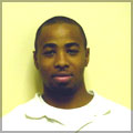
The researcher will solve the Euler equations for a simple iriviscid fluid and the equivalent inviscid magnetohydrodynamics (MHD) equations. An inviscid fluid is a zero viscosity or a nonviscous fluid. These equations describe the temporal and spatial evolution of inviscid compressible fluids. The researcher will perform numerous test runs, on a Unix Workstation, of different computation fluid dynamics (CFD) and MHD flow solvers in one dimension in order to learn characteristic features of each of these flow solvers. Following this, the researcher will integrate the resulting data sets into a technica] report using the mathematical typesetting software, Latex.

Back to Top
Researcher: Vincent A. Davis, Junior/Physics
Mentors: Dr. Kenneth Mighell & Mr. Roy Tucker
Internship: Undergraduate Research Program In Astrophysics REU Program University of Arizona - Tucson, AZ
Title: An Amateur Search For Near-Earth Asteroids
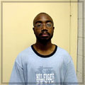
The detection of near-Earth asteroids has recently become a prominent topic in the field of astronomy. There is a strong emphasis on this topic and it mainly comes from the evidence that has lead to the extinction of the dinosaurs and the large crater (Meteor Crater) located in Arizona. Based on this evidence, many research groups are now involved in the search for any asteroids that may pose such a threat to life on the Earth. This topic has been researched for several years and has led to the vast observations by both astronomers and amateurs. The main focus of this summer research project was to do a study on the detection of near earth asteroids. The team learned how to use two image analysis software packages, Image Reduction and Analysis Facility (IRAF) and PinPoint Astrornetric Engine 3.0. The observational data that was used came from unique drift scan charged coupled device (CCD) imagers attached to three 35-centimeter telescopes at Mr. Roy Tucker's observatory, Goodricke-Pigott Observatory, located in Tucson, Arizona. Many nights of observational data were analyzed to find any near-Earth asteroids with the aid of both IRAF and PinPoint. Another aspect of this research project was to become farniliar with IRAF and PinPoint. The team learned how these applications worked and the advantages and disadvantages for each one. Another application from Microsoft Office, Microsoft Excel was also used. With this application, programs were written to serve as a backup system for detecting the asteroids. The team also learned additional observational skills at the 2.1-meter telescope at the Kitt Peak National Observatory during the month of July 2001.

Back to Top
Researcher:
Willie Gilchrist, Sophomore/Computer Science
Mentor: Yohan Baillot
Internship: Naval Research Laboratory
Title: Evaluation of a prototype modular For Battlefield Augment Reality Systems
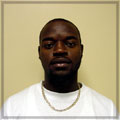
I have learned various aspects of the engineering and computer science field at the Advanced Information Technology Division (AIT), situated on the Naval Research Laboratory (NRL). During my summer internship I worked in the Virtual Reality Laboratory. The Virtual Reality Laboratory conducts research and development in emerging interactive visualization technologies to advance Naval war fighting capabilities. The Virtual Reality Laboratory research is based on virtual reality, augmented reality, and computer graphics.

My objective this summer was to evaluate of all prototype modelers for the Navy Battlefield Augments Reality Systems BARS. I had numerous fundamental tasks. My first task was to understand BARS, well enough to modify and construct a building using the Bamboo software. Bamboo is software system where modulus can make up, and dynamically locate at run time. You can extend the program capabilities while it is running. I was also asked to draw an inside diagram of building 34 deck one and two. With this diagram I was instructed to measure and assemble a BARS model for the inside of building 34. After I assemble the model of building 34 it was then Exporting into BARS. There the outer frame of building 34 was already constructed.


Back to Top
Researcher: Paula R. Harrell, Sophomore/Computer Science
Mentor: Dr. Kuzman Adzievski
Internship: South Carolina State University
Title: Compression and Denoi sing of Astronomical Images Using Wavelets
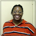
Wavelets provide a powerful and remarkably flexible set of tools for handling the diverse problems in science and engineering. There are a wide range of problems that are being solved using wavelets. Some of them include audio denoi sing, signal compression, object detection, fingerprint compression, diagnosing heart trouble, image enhancement, image denoising, image recognition and speech recognition.

Back to Top
Researcher:
Travis Jennings, Sophomore/Computer Science
Mentor: Dr. Linda Hayden and Dr. Charles Sun
Internship: Undergraduate Research Experience in Ocean and Marine Science
Title: CoastWatch Validation Study
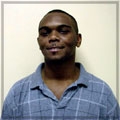
CoastWatch is a National Oceanic and Atmospheric Administration (NOAA) program that provides remotely sensed satellite data to government decision-makers and academic researchers. CoastWatch data is used in a variety of ways including: monitoring sea surface temperatures, studying fish and marine mammal distribution, and aiding in atmospheric forecasting. Studying and monitoring sea surface temperature is very important. Sea surface temperature aids in monitoring coral reef, fisherman decision-making, and the study of other earth system science phenmenna.

The CoastWatch Validation Study team conducted research to determine the reliability and accuracy of Coast Watch. To conduct this study CoastWatch software, AVHRR datasets, and ground truthing were utilized. AVHRR composites were also created and analyzed. Those composites were then compared to data collected from various sources one being the Field Research Facility (FRF. FRF is a coastal and hydraulic facility located in Duck, North Carolina. They conduct research on a variety of activities including coastal dynamics, sediment transport, long-term beach evolution, and measurement techniques.


Back to Top
Researcher: Melvin L. Mattocks, Senior/Computer Science
Mentor: Timothy P. Olsen, Ph.D
Internship: Univ. of Wisconsin-Madison IES-Environmental Remote Sensing Center
Title: Web Serving Landsat 7 Satellite Imagery
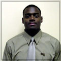
Landsat 7 is a U.S. satellite used to obtain remotely sensed images of the Earth. These include images of land surface and surrounding coastal regions. Landsat 7, the newest of 6 Landsat satellites, detects spectrally filtered radiation at visible, near-infrared, short wave, and thermal infrared frequency bands from Earth. The ETM+ (Enhanced Thematic Mapper Plus) sensor, which makes this achievable, is an eight-band multi-spectral scanning radiometer that is proficient in providing high-resolution image information of the Earth's surface. The ETM+ measures the radiation reflected by land features.

Landsat 7 was developed to see earthly features, rather than surface waters. So the ETM+ sensors are most sensitive to the range of radiance values encountered in features such as forests, agricultural fields, roads, urban areas, etc. This is what the sensors do best. Fortunately, this does not mean that Landsat 7 cannot observe radiation reflected from surface waters. This just means they are not particularly sensitive to that range of radiance (Measure of the energy radiated by an object).

Landsat 7 imagery is an exceptional reference tool for lake monitoring. The imagery acquired by Landsat 7 can be used to analyze, manage, and enhance water quality and characteristics in the lakes. Web serving this information for these purposes and others that have not been considered is ideal.


Back to Top
Researcher: Golar Newby – Junior/Computer Science
Mentor: Simon Julier
Internship: Naval Research Laboratory - Information Technology Department
Title: The Feasibility Of Generating Photometric Models For An Augmented Reality
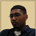
The world is an ever-changing place of danger. The United States is especially vulnerable to attack because we are one of the most influential countries in the world today. With that in mind, the United States government invests several billion dollars a year to ensure that this country has the best means of defense in the world. The task of developing new and innovative technology for defense purposes has found its way to the Naval Research Laboratory's Advance Information and Technologies Department. The task set before the department is to develop a mobile system that military personnel can wear and use to see the layout of an area through clear LCD screens in the form of glasses. The system should allow the users to communicate with each other, communicate with the main base, track the users with Global Positioning Satellites, and be light enough as to not heavily burden the users' bodies.

Needless to say this task could not be completed in a summer, or even a year, therefore the task was been broken down into several sub tasks. The individual selected task for this summer research project was to find a faster and more accurate modeling technique for constructing buildings. Each building was to include several photographs, a photometric file, a VRML 2 file, coordinate system, origin, and orientation. With these items for each building, the mobile computer should be able to place each building into a scene so that the user can look through a pair of tinted glasses and see a computer generated model of the building as well as the actual building in the background. This allowed the user to see the building in front of him as well as other buildings not visible because of obstructions. This task is still one of the vital aspects to the projects progress. Besides the models that have be generated during the research project, the leading group in Photometric modeling from MIT will be coming to compare the results produced from the research they are conducting. The overall research project will greatly benefit from the results that have been generated from both methods.


Back to Top
Researcher: Elizabeth Rascoe, Junior/Computer Science
Mentor: Helen Woodland
Internship: Federal Aviation Administration

I interned with the Federal Aviation Administration (FAA) this summer in Washington, DC. My internship started June 4, 2001 and lasted until August 10, 2001. I was assigned to the ICE-MAN Project. ICE-MAN is a web server that installs and maintains applications for their customers. During my internship, I was ae to go to Kansas City, MO and Oklahoma City, OK to attend monthly technical meetings. I was part of the management side of the ICE-MAN Project. Writing technical evaluations and cutting procurement request were a few of my responsibilities. I also created an ICE-MAN Handbook for other interns to use, upon working the ICE-MAN Project. I enjoyed my experience and would definitely recommend it to others.

Back to Top
Researcher: Carl W. Seward, Sophomore/Mathematics
Mentor: Dr. Claudia Rankins
Internship: Hampton University - Undergraduate Institute in Physics (UniPhy – REU) Program
Title: Form Factors and Distribution Amplitudes for Positively Charged Pions
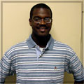
We worked with a low momentum transfer model, the Rankins Model, to describe positively charged pions and to evaluate the pion electric form factors. We used available experimental data to determine how the pion distribution amplitudes looked at small Q2 (or small momentum transfer). In addition, we performed the chi square distribution test to show the fit of the experimental form factors data compared to the calculated data, followed by determining the charge radius of the pion.

Back to Top
Researcher: Eunice D. Smith – Sophomore/Mathematics/Computer Science
Mentors: Dr. Elliott McCrory, Dr. Jean A. Slaughter, and Dr. David J. Ritchie
Internship: Ferrni National Accelerator Laboratory (Fermilab)
Title: What I Break? - What Breaks Me? A Perl Programming Project
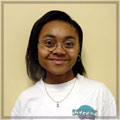
The purpose of my summer project was to expand a Perl program that produced a web page used by the DO Run II experiment at Fermilab. The DO Run II experiment uses complex software to evaluate and store data. This web page was designed to display the names of software packages and their relationships with each other. Compilation and other types of errors in one package could lead to errors in other packages. This web page was designed to distinguish packages with and without errors.

Back to Top
Researcher: Nelson D. Veale – Sophomore/Computer Science
Mentor: Dr. Norman G. Loeb
Internship: Advanced Undergraduate Research using Optical Radiation In the Atmosphere (AURORA Program) - Hampton University
Title: Webpage Development and an HTML Tutorial For the
CERES Inversion Working Group
I created a webpage and a HTML Easy Step Tutorial for the CERES Inversion Working Group. Their webpage wasn't updated. The people on the current webpage have left or retired. So my task was to make a new webpage for the new Inversion Working Group. The webpage consist of an overview of the team, current researchers, publications, conferences, Angular Distribution Models, Validation Results, and Relevant Links. The program and tools being used to create the webpage were HTML, JavaScript, and C Shell Programming. The tutorial consists of easy step-by-step HTML codes and descriptions. The tutorial showed them what each code means, different tasks the code performs, and the common errors seen when using HTML. This would give the In version Team a head start in knowing how to create and update their webpage.

Back to Top
Researcher:
Ernest Walker
Mentors: Mr. Sentiel Creekmore and Dr. Ali Omar, Hampton University
Internship: Undergraduate Research Experience in Ocean and Marine Science
Title: Validation of LITE Tropospheric and Stratospheric Measurements
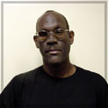
The Lidar-In-Space-Technology-Experiment (LITE) was flown on the STS-64 in September of 1994. LITE was the first lidar developed to fly in Earth's orbit and perform atmospheric studies. The LITE mission had three major objectives: validate instruments for operational spaceborne lidars, explore as many applications of spaceborne lidars as possible, and gather information on the range and variability of cloud, aerosol, and surface return signals for use in designing future systems. LITE used a Nd:YAG laser operating at three channels 1064 nm, 532 nm, and 355 nm to study Earth's lower atmosphere.

In this paper we use a single scatter lidar equation to investigate tropospheric and stratospheric aerosol and temperature measurements derived from the 355 and 532 nm channels. Temperature profiles of 355 nm channel were compared to coincident balloonsonde measurements between 5 and 40km. The results were discussed. The 355 nm channel temperature profiles were corrected for aerosol scattering using the 532 nm channel and an assumed Angstrom coefficient. The RMS between the corrected profiles and the balloonsonde data were computed.


Return to ONR